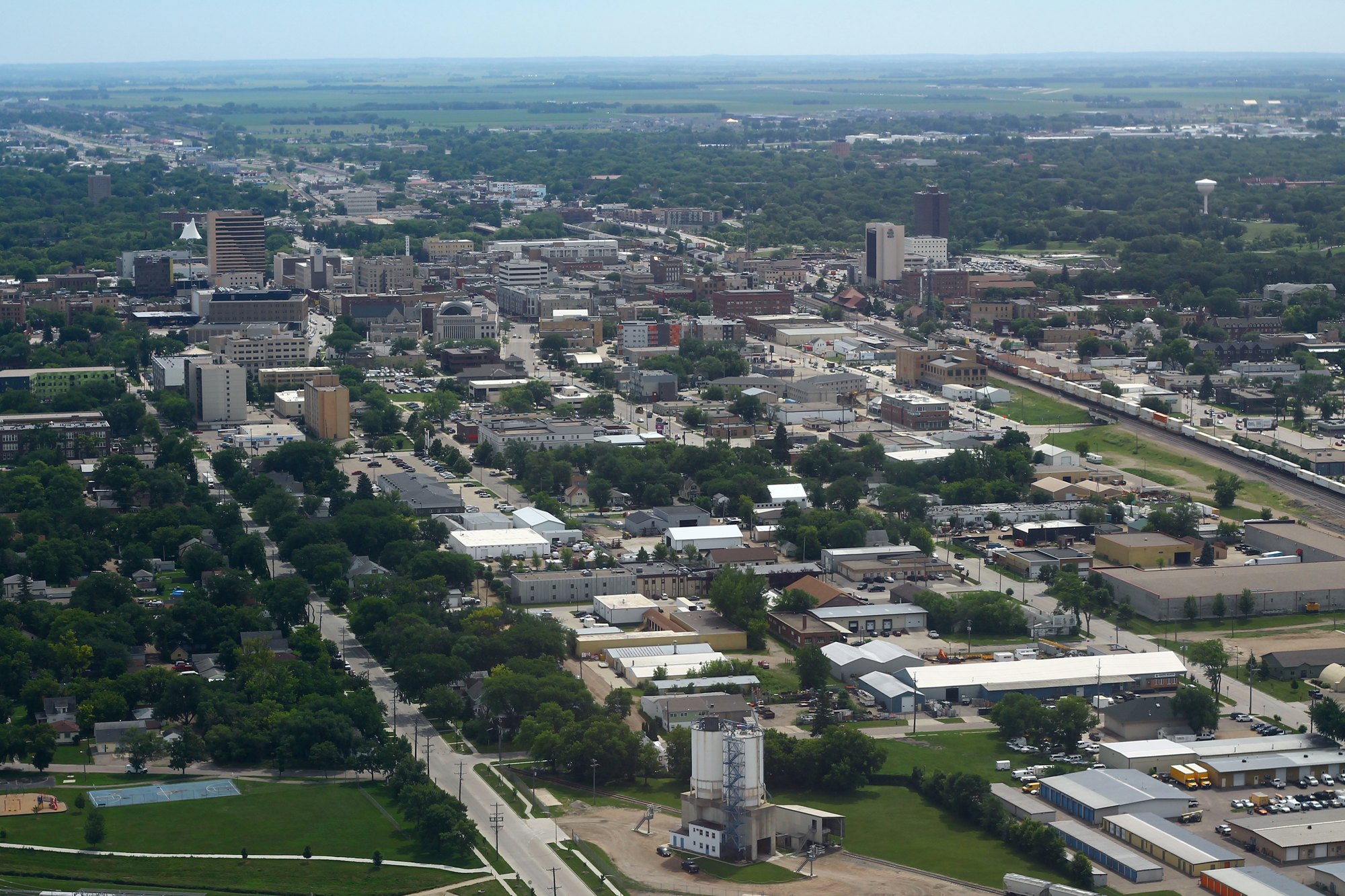
Downtown Fargo viewed from above (2018-07-09 12:39)

Outdoors

Wildlife viewing and birding near Fargo

Refuges, lakes and wild areas near Fargo for wildlife viewing and birdwatching.

31places to see wildlife
29 mito the closest
1within 30 miles

Good to know: Early mornings and evenings are best for wildlife; bring binoculars and keep a respectful distance.

Closest picks

1

Jorgen's Hollow Campground

29 mi southwest · USDA Forest Service

Jorgen's Hollow Campground is located within the Sheyenne National Grassland as part of the 70,000 acres of designated public lands managed by the U.S. Forest Service - Sheyenne National Grassland.

2

Hamden Slough National Wildlife Refuge

41 mi east · Fish and Wildlife Service

Eastern forest dramatically gives way to the western prairie at Hamden Slough National Wildlife Refuge which was established in 1989.

3

Detroit Lakes Wetland Management District

46 mi east · Fish and Wildlife Service

Detroit Lakes Wetland Management District was established in 1962 as part of the Fergus Falls Wetland Management District, with the advent of the Accelerated Small Wetlands Acquisition Program.

Map of all 31 places

Map of 31 places loads as you scroll.

Within 30 miles (1)

29 mi southwest · USDA Forest Service · Campground

Jorgen's Hollow Campground

Jorgen's Hollow Campground is located within the Sheyenne National Grassland as part of the 70,000 acres of designated public lands managed by the U.S. Forest Service - Sheyenne National Grassland.

  • Archery
  • Backpacking
  • Biking
  • Birding
  • Camping
  • Canoeing
  • Fishing
  • Hiking

30 to 75 miles (11)

41 mi east · Fish and Wildlife Service

Hamden Slough National Wildlife Refuge

Eastern forest dramatically gives way to the western prairie at Hamden Slough National Wildlife Refuge which was established in 1989.

  • Backpacking
  • Birding
  • Cross Country Skiing
  • Fishing
  • Hiking
  • Hunting
  • Nature education
  • Non-Motorized Boating

46 mi east · Fish and Wildlife Service

Detroit Lakes Wetland Management District

Detroit Lakes Wetland Management District was established in 1962 as part of the Fergus Falls Wetland Management District, with the advent of the Accelerated Small Wetlands Acquisition Program.

  • Archery
  • Backpacking
  • Birding
  • Cross Country Skiing
  • Fishing
  • Hiking
  • Hunting
  • Nature education

54 mi southeast · US Army Corps of Engineers

Orwell Lake

Much of the project area is used for wildlife habitat development by Minnesota Department of Natural Resources. Many lakes in vicinity.

  • Picnicking
  • Wildlife viewing

56 mi east · Fish and Wildlife Service

Tamarac National Wildlife Refuge

Tamarac National Wildlife Refuge was established as a refuge and breeding ground for migratory birds and other wildlife.

  • Birding
  • Boating
  • Cross Country Skiing
  • Educational Programs
  • Fishing
  • Hiking
  • Hunting
  • Ice Fishing

57 mi southeast · Fish and Wildlife Service

Fergus Falls Wetland Management District

to the Fergus Falls Wetland Management District, where we care for almost 50,000 acres of wildlife habitat scattered across five counties in western Minnesota.

  • Birding
  • Cross Country Skiing
  • Educational Programs
  • Fishing
  • Hiking
  • Hunting
  • Nature education
  • Non-Motorized Boating

57 mi west · Fish and Wildlife Service

Valley City Wetland Management District

Established in 1971, Valley City Wetland Management District manages both Service-owned waterfowl production areas as well as wetland and grassland easements on private lands located in Barnes, Cass, Griggs, Steele, and Traill counties.

  • Birding
  • Fishing
  • Hunting
  • Ice Fishing
  • Photography
  • Ranger programs
  • Wildlife viewing

58 mi west · US Army Corps of Engineers · Campground

West Ashtabula Crossing

West Ashtabula Crossing Campground is located on 23 developed acres adjacent to Lake Ashtabula in eastern North Dakota. It is very popular and fills up on most weekends.

  • Camping
  • Hiking
  • Swimming
  • Wildlife viewing
  • Winter sports

60 mi west · US Army Corps of Engineers

Ashtabula Lake

The Baldhill Dam, Lake Ashtabula Project is located in eastern North Dakota, in the heart of the prairie pothole country.

  • Boating
  • Camping
  • Fishing
  • Hiking
  • Hotel/Lodge/Resort Privately Owned
  • Nature education
  • Picnicking
  • Water sports

65 mi northeast · Fish and Wildlife Service

Rydell National Wildlife Refuge

Rydell National Wildlife Refuge was established in 1992 by means of a land donation from the Richard King Mellon Foundation.

  • Backpacking
  • Biking
  • Birding
  • Cross Country Skiing
  • Fishing
  • Hiking
  • Hunting
  • Photography

65 mi southwest · Fish and Wildlife Service

Tewaukon National Wildlife Refuge

Amazing flights of thousands of waterfowl, shorebirds, and wading birds are visible on the Refuge during spring and fall migration as they rest and feed on Refuge wetlands.

  • Boating
  • Fishing
  • Hunting
  • Ice Fishing
  • Photography
  • Ranger programs
  • Wildlife viewing

65 mi southwest · Fish and Wildlife Service

Tewaukon Wetland Management District

Established in 1960, the District manages both U.S. Fish and Wildlife Service-owned waterfowl production areas as well as wetland and grassland easements on private lands in Ransom, Richland, and Sargent counties.

  • Boating
  • Fishing
  • Hunting
  • Photography
  • Ranger programs
  • Wildlife viewing

75 miles and farther (19)

76 mi south · US Army Corps of Engineers

Traverse Lake

The Lake Traverse Project is a multipurpose project located on the Minnesota ? South Dakota border. The project consists of two dams, one dike and two lakes, Traverse and Mud.

  • Boating
  • Fishing
  • Picnicking
  • Water sports
  • Wildlife viewing

91 mi west · US Army Corps of Engineers

Pipestem Lake

Pipestem Dam, ND is located north of Jamestown, on Pipestem Creek. The 840-acre Pipestem Lake offers year-round recreational opportunities including camping, picnicking, and wildlife viewing.

  • Boating
  • Nature education
  • Picnicking
  • Water sports
  • Wildlife viewing

97 mi southeast · Fish and Wildlife Service

Morris Wetland Management District

Morris Wetland Management District includes 249 waterfowl production areas - small parcels of wetlands and grasslands - scattered throughout an eight-county area and encompassing 54,307 total acres.

  • Backpacking
  • Birding
  • Boating
  • Cross Country Skiing
  • Educational Programs
  • Fishing
  • Hiking
  • Hunting

99 mi west · Fish and Wildlife Service

Arrowwood National Wildlife Refuge

Established in 1935 as a refuge and breeding ground for migratory birds and other wildlife this 15,973-acre refuge is an important stopover for many species of birds as they journey north and south during annual migrations.

  • Birding
  • Boating
  • Fishing
  • Hunting
  • Ice Fishing
  • Photography
  • Ranger programs
  • Wildlife viewing

99 mi west · Fish and Wildlife Service

Arrowwood Wetland Management District

Established in 1961, the District manages both Service-owned waterfowl production areas as well as wetland and grassland easements on private lands in Foster and Eddy counties.

  • Boating
  • Fishing
  • Hunting
  • Photography
  • Ranger programs
  • Wildlife viewing

102 mi south · Fish and Wildlife Service

Waubay National Wildlife Refuge

The National Wildlife Refuge System, within the U.S. Fish and Wildlife Service, manages a national network of lands and waters set aside to conserve America's fish, wildlife, and plants.

  • Boating
  • Educational Programs
  • Fishing
  • Hunting
  • Photography
  • Ranger programs
  • Wildlife viewing

102 mi south · Fish and Wildlife Service

Waubay Wetland Management District

Wetland Management Districts are little known but very important components of the National Wildlife Refuge System.

  • Educational Programs
  • Fishing
  • Hunting
  • Photography
  • Wildlife viewing

106 mi southwest · Fish and Wildlife Service

Sand Lake National Wildlife Refuge

For thousands of years, man has been attracted to the Sand Lake area in search of wildlife. Early-day Indians and later fur traders and white explorers, such as John C. Fremont and Joseph N.

  • Birding
  • Fishing
  • Hunting
  • Photography
  • Ranger programs
  • Wildlife viewing

107 mi north · Fish and Wildlife Service

Agassiz National Wildlife Refuge

Agassiz National Wildlife Refuge was established in 1937. Its primary purpose was to be a refuge and breeding ground for migratory birds and other wildlife.

  • Biking
  • Birding
  • Cross Country Skiing
  • Hiking
  • Hunting
  • Nature education
  • Photography
  • Picnicking

108 mi west · Fish and Wildlife Service

Kulm Wetland Management District

The Kulm Wetland Management District was established in July 1971. It is located in the Prairie Pothole Region of North America--a grassland landscape formed by glaciers and marked by numerous wetlands called potholes.

  • Birding
  • Boating
  • Fishing
  • Hunting
  • Ice Fishing
  • Nature education
  • Paddling
  • Photography

111 mi east · USDA Forest Service · Campground

Cass Lake Loop

Cass Lake Loop is part of the Norway Beach Recreation Area on beautiful Cass Lake in north central Minnesota. Visitors enjoy the area for its excellent boating and fishing opportunities.

  • Biking
  • Boating
  • Camping
  • Fishing
  • Hiking
  • Swimming
  • Water sports
  • Wildlife viewing

113 mi south · Fish and Wildlife Service

Big Stone National Wildlife Refuge

Big Stone National Wildlife Refuge was officially established May 21, 1975 when 10,540 acres of land purchased by the U.S. Army Corps of Engineers were transferred to the U.S. Fish and Wildlife Service.

  • Biking
  • Birding
  • Boating
  • Cross Country Skiing
  • Educational Programs
  • Fishing
  • Hiking
  • Hunting

113 mi south · Fish and Wildlife Service

Big Stone Wetland Management District

Big Stone Wetland Management District was established in 1996 and includes 23 waterfowl production areas. These small parcels of wetlands and grasslands are scattered throughout a two-county area and encompass more than 4,000 total acres.

  • Birding
  • Fishing
  • Hunting
  • Nature education
  • Ranger programs
  • Wood Cutting

114 mi east · USDA Forest Service · Campground

Norway Beach Picnic Shelter

Norway Beach Picnic Shelter is part of the Norway Beach Recreation Area on the southern shores of beautiful Cass Lake in north central Minnesota.

  • Biking
  • Boating
  • Camping
  • Fishing
  • Hiking
  • History
  • Ranger programs
  • Swimming

114 mi east · USDA Forest Service · Campground

Wanaki Loop

Wanaki Loop is part of the Norway Beach Recreation Area, at the southern shores of beautiful Cass Lake in north central Minnesota. The campground is a perfect location for family camping, with excellent boating and fishing opportunities.

  • Biking
  • Boating
  • Camping
  • Fishing
  • Hiking
  • History
  • Ranger programs
  • Swimming

115 mi east · USDA Forest Service · Campground

Chippewa Loop

Chippewa Loop is part of the Norway Beach Recreation Area, on the southern shores of beautiful Cass Lake in north central Minnesota. The campground is a perfect location for family camping, with excellent boating and fishing opportunities.

  • Biking
  • Birding
  • Boating
  • Camping
  • Fishing
  • History
  • Ranger programs
  • Swimming

117 mi east · USDA Forest Service · Campground

Bimijiwan Recreation Area

Knutson Dam Campground is located on the northeastern shores of Cass Lake and the Mississippi River. Recreation Cass Lake offers many recreational activities, including boating, water skiing and swimming.

  • Boating
  • Camping
  • Fishing
  • Swimming
  • Water sports
  • Wildlife viewing

120 mi northeast · USDA Forest Service · Campground

Webster Lake

Located 10 miles south of Blackduck, Minnesota on County Road 31. Follow Forest Road 2207 east for one mile, then drive two miles south on Forest Road 2236, the campground provides access to Webster Lake, a picnic area and a large trail…

  • Camping
  • Canoeing
  • Fishing
  • Hiking
  • Swimming
  • Water Access
  • Wildlife viewing

122 mi east · US Army Corps of Engineers · Campground

Gull Lake Recreation Area

Gull Lake Recreation Area offers something for everyone with boating, hiking, fishing and swimming at Minnesota's famous Gull Lake, the largest of the 10 lakes on the Gull Chain of Lakes.

  • Biking
  • Birding
  • Boating
  • Camping
  • Canoeing
  • Evening Programs
  • Fishing
  • Hiking

Distances are straight-line miles from the center of Fargo. Listings come from Recreation.gov’s federal recreation database; check each official page for hours, fees, fire restrictions and closures before you go.

Get outside around Fargo

Inside the Plains Art Museum video thumbnail

THINGS TO DO · YOUTUBE SHORT

Inside the Plains Art Museum

Prairie Public’s Prairie Mosaic goes behind the scenes at the Plains Art Museum and its national, regional and local exhibitions.

Watch on YouTube ↗

More outdoors near Fargo

Questions

Where is the closest place for wildlife & birding near Fargo?

Jorgen's Hollow Campground (USDA Forest Service), about 29 miles southwest of Fargo as the crow flies. Next are Hamden Slough National Wildlife Refuge (41 mi) and Detroit Lakes Wetland Management District (46 mi).

Who manages these places?

Federal agencies including Fish and Wildlife Service, USDA Forest Service, US Army Corps of Engineers. Each listing links to its official page for hours, fees, closures and current conditions.

Fargo AI

Your Fargo local guide
Hey there!

I'm Fargo AI. Ask about neighborhood food, independent shops, local history or planning a visit.

AI recommendations may be inaccurate. Verify hours and prices. Questions are processed by Cloudflare. Privacy