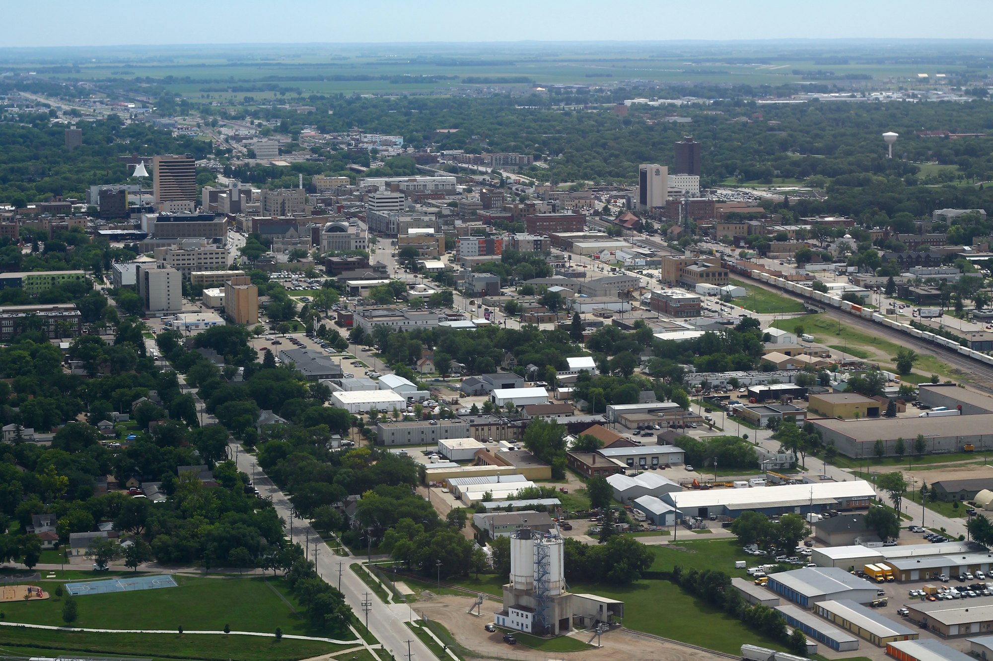
Downtown Fargo viewed from above (2018-07-09 12:39)

Outdoors

Hiking near Fargo

National forests, parks, lakes and recreation areas with hiking trails near Fargo, closest first.

22places to hike
29 mito the closest
1within 30 miles
April–June, August–Octoberbest months

Good to know: Carry more water than you think you need, check the managing agency’s page for trail closures and fire restrictions, and start early on hot days.

Closest picks

1

Jorgen's Hollow Campground

29 mi southwest · USDA Forest Service

Jorgen's Hollow Campground is located within the Sheyenne National Grassland as part of the 70,000 acres of designated public lands managed by the U.S. Forest Service - Sheyenne National Grassland.

2

Hamden Slough National Wildlife Refuge

41 mi east · Fish and Wildlife Service

Eastern forest dramatically gives way to the western prairie at Hamden Slough National Wildlife Refuge which was established in 1989.

3

Detroit Lakes Wetland Management District

46 mi east · Fish and Wildlife Service

Detroit Lakes Wetland Management District was established in 1962 as part of the Fergus Falls Wetland Management District, with the advent of the Accelerated Small Wetlands Acquisition Program.

Map of all 22 places

Map of 22 places loads as you scroll.

Within 30 miles (1)

29 mi southwest · USDA Forest Service · Campground

Jorgen's Hollow Campground

Jorgen's Hollow Campground is located within the Sheyenne National Grassland as part of the 70,000 acres of designated public lands managed by the U.S. Forest Service - Sheyenne National Grassland.

  • Archery
  • Backpacking
  • Biking
  • Birding
  • Camping
  • Canoeing
  • Fishing
  • Hiking

30 to 75 miles (10)

41 mi east · Fish and Wildlife Service

Hamden Slough National Wildlife Refuge

Eastern forest dramatically gives way to the western prairie at Hamden Slough National Wildlife Refuge which was established in 1989.

  • Backpacking
  • Birding
  • Cross Country Skiing
  • Fishing
  • Hiking
  • Hunting
  • Nature education
  • Non-Motorized Boating

46 mi east · Fish and Wildlife Service

Detroit Lakes Wetland Management District

Detroit Lakes Wetland Management District was established in 1962 as part of the Fergus Falls Wetland Management District, with the advent of the Accelerated Small Wetlands Acquisition Program.

  • Archery
  • Backpacking
  • Birding
  • Cross Country Skiing
  • Fishing
  • Hiking
  • Hunting
  • Nature education

56 mi east · Fish and Wildlife Service

Tamarac National Wildlife Refuge

Tamarac National Wildlife Refuge was established as a refuge and breeding ground for migratory birds and other wildlife.

  • Birding
  • Boating
  • Cross Country Skiing
  • Educational Programs
  • Fishing
  • Hiking
  • Hunting
  • Ice Fishing

57 mi southeast · Fish and Wildlife Service

Fergus Falls Wetland Management District

to the Fergus Falls Wetland Management District, where we care for almost 50,000 acres of wildlife habitat scattered across five counties in western Minnesota.

  • Birding
  • Cross Country Skiing
  • Educational Programs
  • Fishing
  • Hiking
  • Hunting
  • Nature education
  • Non-Motorized Boating

58 mi west · US Army Corps of Engineers · Campground

Eggerts Landing

The Eggerts Landing Campground is located on Lake Ashtabula in eastern North Dakota. With thick forests, secluded sites and lake access, it is the most popular campground in the area.

  • Camping
  • Hiking
  • Swimming

58 mi west · US Army Corps of Engineers · Campground

West Ashtabula Crossing

West Ashtabula Crossing Campground is located on 23 developed acres adjacent to Lake Ashtabula in eastern North Dakota. It is very popular and fills up on most weekends.

  • Camping
  • Hiking
  • Swimming
  • Wildlife viewing
  • Winter sports

59 mi west · US Army Corps of Engineers · Campground

East Ashtabula Crossing

The East Ashtabula Crossing Campground is located on 12 developed acres adjacent to Lake Ashtabula in eastern North Dakota. It is one of the most popular campgrounds in the area.

  • Camping
  • Hiking
  • Picnicking
  • Swimming

60 mi west · US Army Corps of Engineers

Ashtabula Lake

The Baldhill Dam, Lake Ashtabula Project is located in eastern North Dakota, in the heart of the prairie pothole country.

  • Boating
  • Camping
  • Fishing
  • Hiking
  • Hotel/Lodge/Resort Privately Owned
  • Nature education
  • Picnicking
  • Water sports

60 mi west · US Army Corps of Engineers · Campground

Mel Rieman Rec

The Mel Rieman Campground and Recreation Area is a 70-acre facility on the shoreline of Lake Ashtabula in eastern North Dakota. The campground is known for its spectacular sunset views.

  • Camping
  • Fishing
  • Hiking
  • Picnicking
  • Swimming

65 mi northeast · Fish and Wildlife Service

Rydell National Wildlife Refuge

Rydell National Wildlife Refuge was established in 1992 by means of a land donation from the Richard King Mellon Foundation.

  • Backpacking
  • Biking
  • Birding
  • Cross Country Skiing
  • Fishing
  • Hiking
  • Hunting
  • Photography

75 miles and farther (11)

89 mi west · Bureau of Reclamation

Jamestown Reservoir

Jamestown Dam and Reservoir are features of the PSMBP - Jamestown Dam . Located in central North Dakota the reservoir provides flood protection to areas downstream.

  • Biking
  • Boating
  • Camping
  • Fishing
  • Hiking
  • Hunting
  • Picnicking
  • Recreational Vehicles

97 mi southeast · Fish and Wildlife Service

Morris Wetland Management District

Morris Wetland Management District includes 249 waterfowl production areas - small parcels of wetlands and grasslands - scattered throughout an eight-county area and encompassing 54,307 total acres.

  • Backpacking
  • Birding
  • Boating
  • Cross Country Skiing
  • Educational Programs
  • Fishing
  • Hiking
  • Hunting

107 mi north · Fish and Wildlife Service

Agassiz National Wildlife Refuge

Agassiz National Wildlife Refuge was established in 1937. Its primary purpose was to be a refuge and breeding ground for migratory birds and other wildlife.

  • Biking
  • Birding
  • Cross Country Skiing
  • Hiking
  • Hunting
  • Nature education
  • Photography
  • Picnicking

111 mi east · USDA Forest Service · Campground

Cass Lake Loop

Cass Lake Loop is part of the Norway Beach Recreation Area on beautiful Cass Lake in north central Minnesota. Visitors enjoy the area for its excellent boating and fishing opportunities.

  • Biking
  • Boating
  • Camping
  • Fishing
  • Hiking
  • Swimming
  • Water sports
  • Wildlife viewing

113 mi south · Fish and Wildlife Service

Big Stone National Wildlife Refuge

Big Stone National Wildlife Refuge was officially established May 21, 1975 when 10,540 acres of land purchased by the U.S. Army Corps of Engineers were transferred to the U.S. Fish and Wildlife Service.

  • Biking
  • Birding
  • Boating
  • Cross Country Skiing
  • Educational Programs
  • Fishing
  • Hiking
  • Hunting

113 mi east · USDA Forest Service · Campground

Stony Point

Reservations to all Chippewa National Forest Campgrounds can be made six months in advance. Stony Point is located on beautiful Leech Lake, in the heart of Minnesota's Chippewa National Forest.

  • Boating
  • Camping
  • Fishing
  • Hiking
  • Swimming

114 mi east · USDA Forest Service · Campground

Norway Beach Picnic Shelter

Norway Beach Picnic Shelter is part of the Norway Beach Recreation Area on the southern shores of beautiful Cass Lake in north central Minnesota.

  • Biking
  • Boating
  • Camping
  • Fishing
  • Hiking
  • History
  • Ranger programs
  • Swimming

114 mi east · USDA Forest Service · Campground

Wanaki Loop

Wanaki Loop is part of the Norway Beach Recreation Area, at the southern shores of beautiful Cass Lake in north central Minnesota. The campground is a perfect location for family camping, with excellent boating and fishing opportunities.

  • Biking
  • Boating
  • Camping
  • Fishing
  • Hiking
  • History
  • Ranger programs
  • Swimming

120 mi northeast · USDA Forest Service · Campground

Webster Lake

Located 10 miles south of Blackduck, Minnesota on County Road 31. Follow Forest Road 2207 east for one mile, then drive two miles south on Forest Road 2236, the campground provides access to Webster Lake, a picnic area and a large trail…

  • Camping
  • Canoeing
  • Fishing
  • Hiking
  • Swimming
  • Water Access
  • Wildlife viewing

122 mi east · US Army Corps of Engineers · Campground

Gull Lake Recreation Area

Gull Lake Recreation Area offers something for everyone with boating, hiking, fishing and swimming at Minnesota's famous Gull Lake, the largest of the 10 lakes on the Gull Chain of Lakes.

  • Biking
  • Birding
  • Boating
  • Camping
  • Canoeing
  • Evening Programs
  • Fishing
  • Hiking

124 mi east · USDA Forest Service · Campground

Winnie Campground - USFS

Winnie Campground is remotely located on the west side of Lake Winnibigoshish in the heart of the Chippewa National Forest. Visitors come to the area to enjoy boating, trophy muskie fishing and beautiful scenery.

  • Boating
  • Camping
  • Fishing
  • Hiking
  • Water sports

Distances are straight-line miles from the center of Fargo. Listings come from Recreation.gov’s federal recreation database; check each official page for hours, fees, fire restrictions and closures before you go.

Get outside around Fargo

Inside the Plains Art Museum video thumbnail

THINGS TO DO · YOUTUBE SHORT

Inside the Plains Art Museum

Prairie Public’s Prairie Mosaic goes behind the scenes at the Plains Art Museum and its national, regional and local exhibitions.

Watch on YouTube ↗

More outdoors near Fargo

Questions

Where is the closest place for hiking near Fargo?

Jorgen's Hollow Campground (USDA Forest Service), about 29 miles southwest of Fargo as the crow flies. Next are Hamden Slough National Wildlife Refuge (41 mi) and Detroit Lakes Wetland Management District (46 mi).

When is the best time for hiking near Fargo?

Based on Fargo’s average highs, April–June, August–October. Conditions at higher elevations can be much cooler.

Who manages these places?

Federal agencies including Fish and Wildlife Service, USDA Forest Service, US Army Corps of Engineers. Each listing links to its official page for hours, fees, closures and current conditions.

Fargo AI

Your Fargo local guide
Hey there!

I'm Fargo AI. Ask about neighborhood food, independent shops, local history or planning a visit.

AI recommendations may be inaccurate. Verify hours and prices. Questions are processed by Cloudflare. Privacy